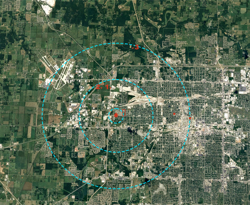


Map 1 (left)
This is an overall map of the area where Naomi went missing.
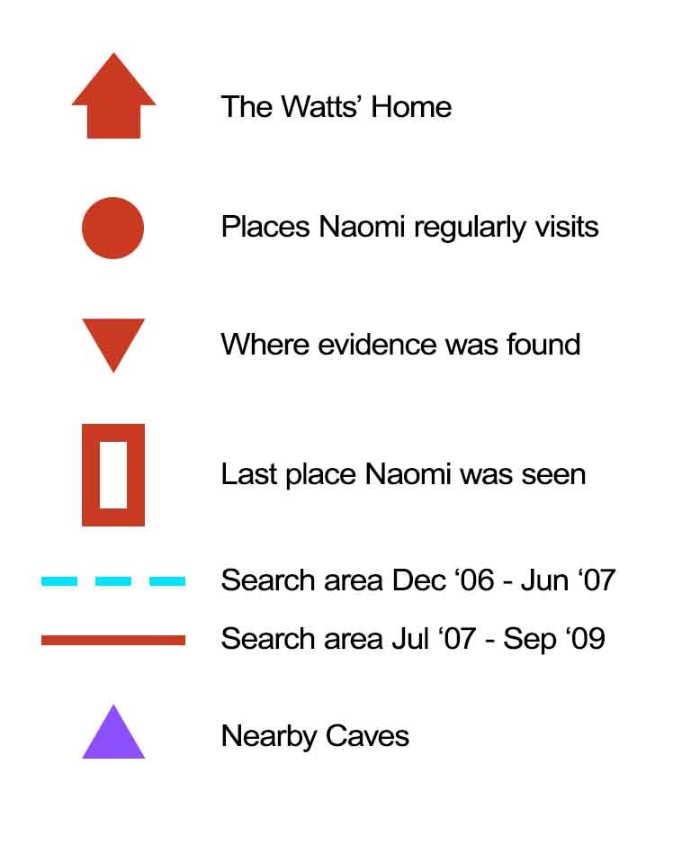
- There are 3 blue circles on the map, marking the areas initially searched between December 2006 and June 2007. From smallest to largest: 1/2 mile radius, 3 mile radius, and 6 mile radius.
- The red rectangle to the right of Naomi's home is L.A. Wise Park, the park she hung out with friends the night of her disappearance.
- The red dot at the right edge of the largest blue circle is Naomi's high school (Central High School).
- The red dot to the left of Central High marks where Naomi worked: Wommak's Great American Food Store (1130 N Grant Ave).
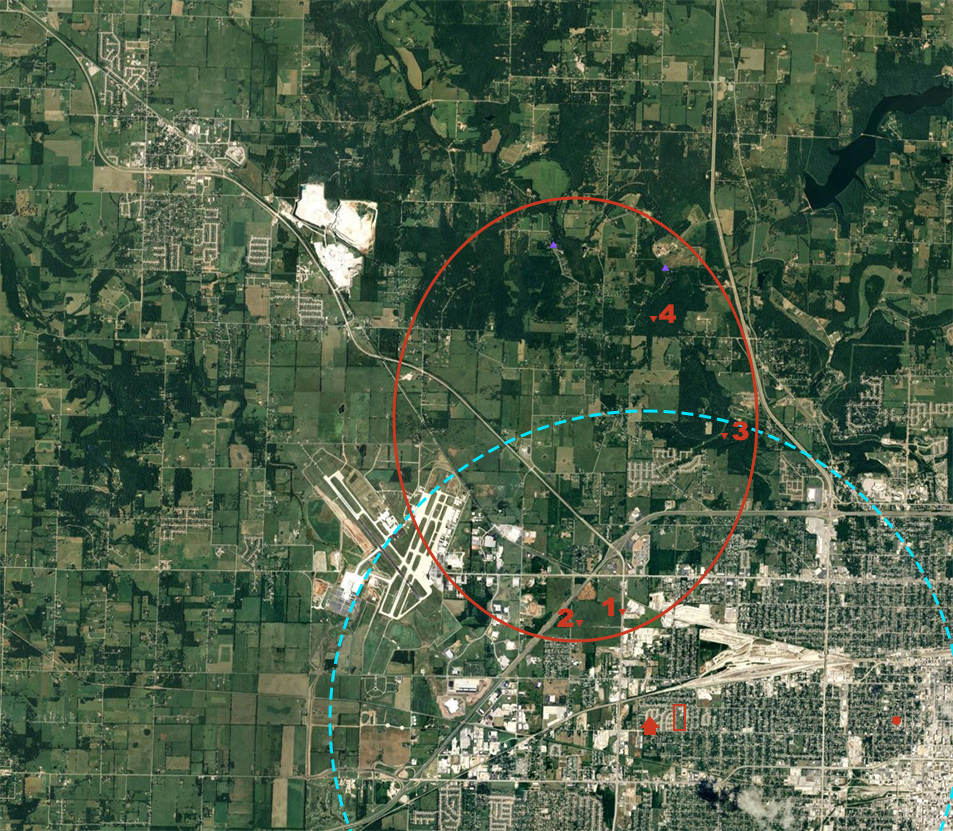
- The red triangles on the map mark points where relevant evidence was recovered: (1) Possible CCTV footage capturing Naomi, (2) Naomi's phone was found in this field, (3) A bracelet that belonged to Naomi, was found in this clearing, (4) A mitten that belonged to Naomi was found in this forested area.
Map 2 (right)
This is an expanded version of Map 1, that shows further search efforts.
- The red circle marks the area searched between July 2007 and September 2009. This was when the search efforts were dialed back.